
The Trail + Loop
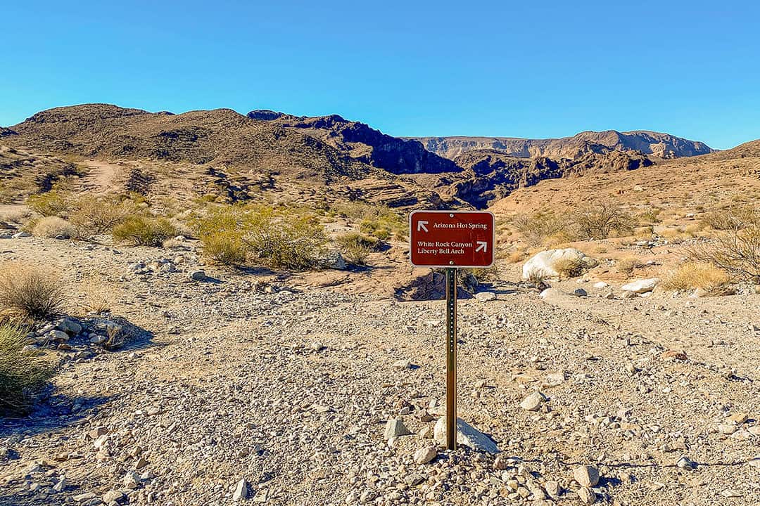
You can hike to Arizona Hot Springs multiple ways. The main lollipop loop encompasses the White Rock Canyon Trail and the Hot Spring Canyon Trail, starting from the same parking lot. After 0.4 miles, you will come to a split with a sign pointing to White Rock Canyon on the right and the Hot Spring Canyon on the left.
See More: 15 Fun Outdoor Activities in Las Vegas
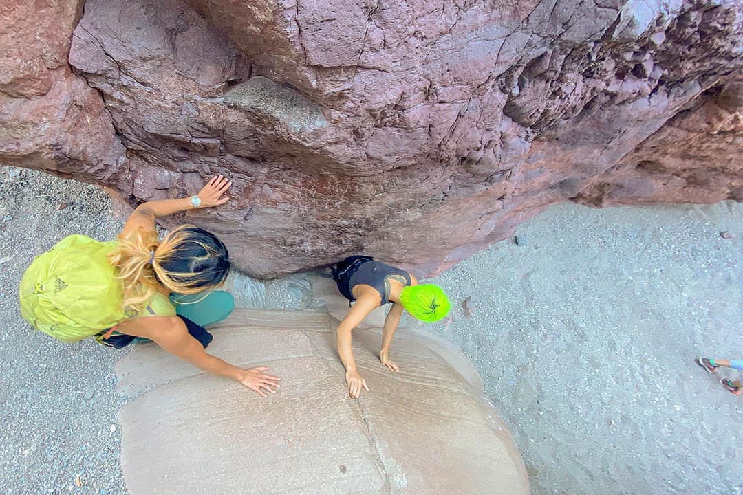
Most guides will instruct you to start on the White Rock Canyon Trail, make your way down to the river, then cut back up to climb a 20 ft 18 rung ladder that leads to the hot springs. Then you head back via the Hot Spring Canyon Trail.
We did the hike in reverse. The plan was to hike back the same way since it cuts down the distance, but we decided last minute to complete the entire loop.
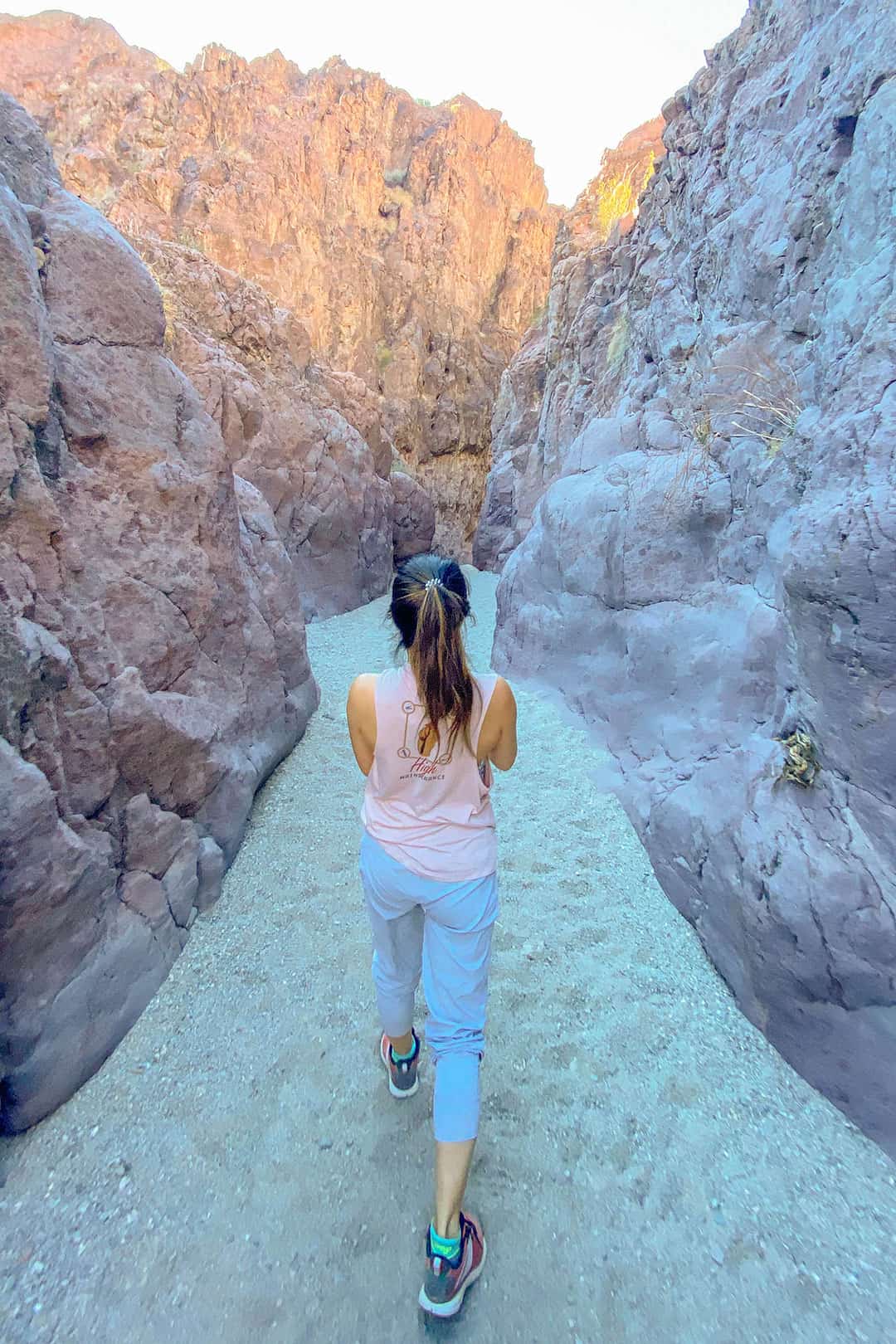
The Hot Spring Canyon Trail was steeper, with some loose gravel, making it slippery, while the White Rock Canyon Trail is gradual but almost entirely on loose gravel (not fun IMO).
Most of the trail is easy to follow. We recommend downloading the GPS map or offline google maps. The one confusing portion is near the river. If you go down to the beach, you need to backtrack to find White Rock Canyon Trail. The trail along the river also cuts back and forth, so look for markers (some not along the river).
Now that we’ve done both sides of the trail, if we were to do the hike again, we would only do the Hot Spring Canyon Trail down and back. The only downside is that you will miss views of the Colorado River from above.
Local Tip: You can extend the hike by adding the Liberty Bell Arch trail, an offshoot of the White Rock Canyon Trail.
There has never been a better time to plan your next trip and make your Dream vacation a reality . Whether you've been dreaming of relaxing on a sun-kissed beach, exploring ancient cities, or embarking on an epic adventure, now is the perfect moment to make it happen.


")

